Rwanda’s Path toward establishing UNESCO Global Geoparks: Communities at the heart of conservation and development
As Rwanda continues to position itself as a hub for sustainable tourism and environmental conservation, experts emphasize that local communities are the cornerstone of preserving and benefiting from Geoparks areas recognized for their geological, historical, and cultural significance.
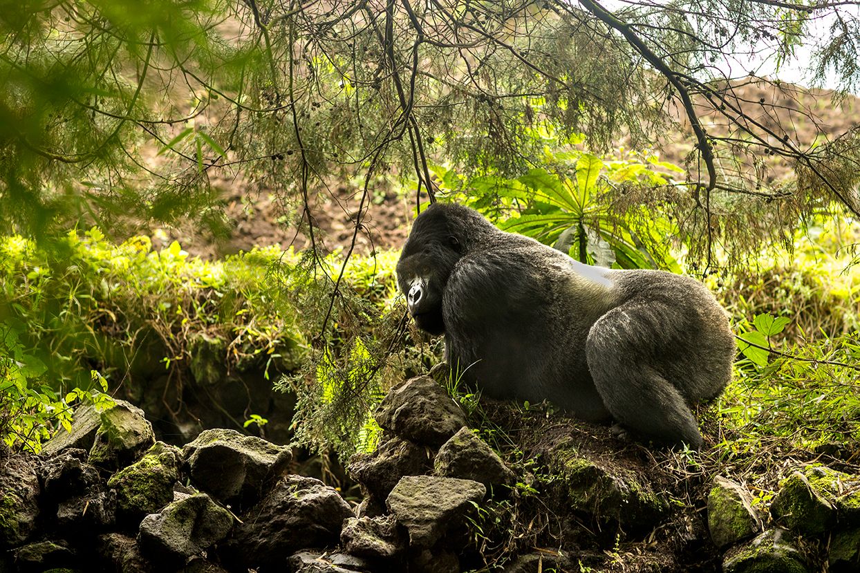
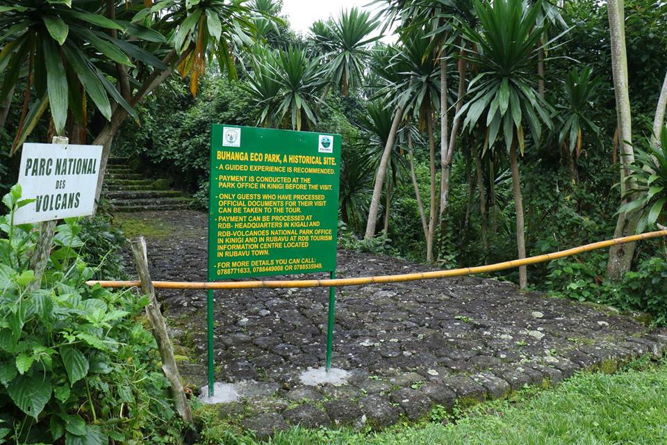
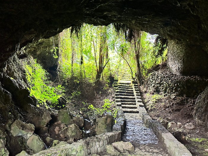
Although Rwanda does not yet have a UNESCO Global Geopark officially recognized at the international level, several regions,particularly in the Northern Province, home to the five Virunga volcanoes (Karisimbi, Muhabura, Sabyinyo, Gahinga, and Bisoke), the twin lakes Burera and Ruhondo (of volcanic origin), the Rugezi wetland in Burera District, and the culturally rich Buhanga Eco-Park possess distinctive geological and geomorphological features that can be sustainably utilized through community engagement.

A Geopark is not merely about rocks,it embodies the life of the people who live around them. It integrates earth sciences with human livelihood, creating a space where economy, education, culture, and tourism coexist in harmony.
Saraphine Uwase, a resident of Burera District, underscores the importance of community participation in the conservation and development of such sites:
“When people are excluded from conservation, it feels like outsiders’ work. But once they understand that a Geopark can create jobs, improve their welfare, and educate their children, they become its guardians.”
In the districts of Musanze, Burera, and Rutsiro (the latter hosting the new Gishwati–Mukura National Park),local residents have begun leveraging knowledge and awareness campaigns on forest and park conservation.
Mukarugwiza Domina, a local resident, testifies that environmental education changed her perception:
“I used to sell firewood, but now we’ve been taught to farm without cutting trees. When visitors come to see our natural attractions, we realize these resources bring us direct benefits, so we must protect them.”
Jean Bosco Habimana, an artisan from Musanze, sees geotourism as an opportunity for local enterprise:
“We produce handicrafts inspired by local rocks and mountains. Tourists are curious about how we make them, and that’s how we earn income and jobs.”
Students in tourism studies also affirm that knowledge is the foundation of transformation. Educating communities about the value of rocks, mountains, and landscapes builds respect for their environment and reveals economic opportunities within it.
Similar models have succeeded in Kenya and Tanzania, where locals collaborate with authorities in data collection, guiding visitors, and developing cultural heritage activities that enhance Geopark value.
For example, the NgorongoroLengai Geopark in Tanzania demonstrates how communities can co-manage mountain ecosystems, preserving them while generating income through cultural and geo-heritage tourism.
In Morocco, the M’Goun Geopark empowered locals to launch small-scale enterprises in crafts, geotourism, and geo-education,significantly improving their livelihoods.
Globally, Arouca Geopark (Portugal) and Araripe Geopark (Brazil) highlight the transformative power of community-driven conservation, showing that a Geopark belongs not only to scientists but to society as a whole.
Experts agree that establishing Geoparks in Rwanda will require political will, cross-sectoral collaboration, and community participation, especially among educators and youth.
According to Ir. Dominique Mvunabandi, Director of Science, Technology and Innovation Unit at UNESCO Rwanda National Commission:
“A Geopark is a source of sustainable development. But development that excludes communities is never sustainable. Students studying tourism have a duty to share their knowledge with local people.”
Mvunabandi further notes that Geoparks benefit both residents and the tourism sector by aligning with their land, history, and culture.
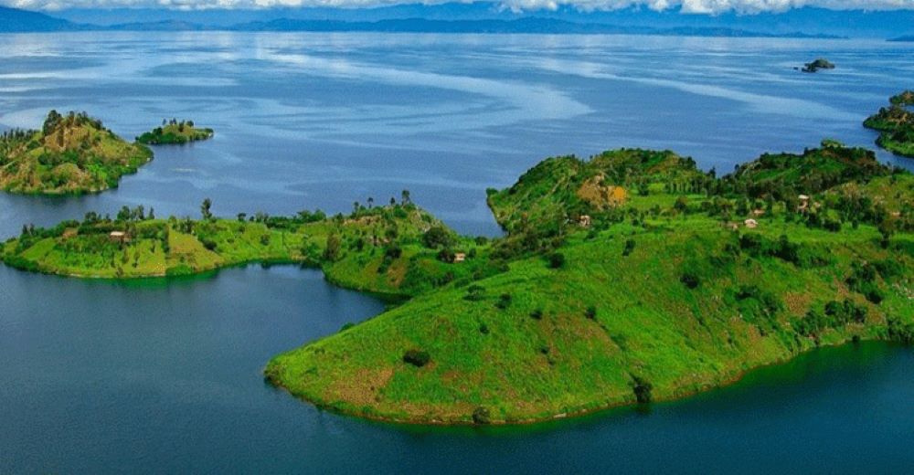
“In Burera District, for instance, the twin lakes Burera and Ruhondo are interconnected through the Rugezi wetland and contribute to hydroelectric power generation at Ntaruka Dam. Local people benefit economically, while Buhanga Eco-Park preserves unique cultural heritage. The volcanic chain shared with Uganda and the DRC shapes our identity through its height and geological structure.”
Speaking about the connection between Red Rocks Initiative’s long-term work and the Geopark vision, Greg Bakunzi, the Director of Red Rocks Initiative for Sustainable Development, emphasized that both share the same foundation, bringing people and nature together for lasting impact.
“The Geopark concept doesn’t replace what we’ve been doing; it deepens it,” said Greg Bakunzi. “For years, we’ve been helping communities see value in their environment and culture. The Geopark gives this vision a stronger, global platform, it turns our landscapes into living classrooms and our culture into a bridge between conservation and development.”
Dr. Cedrick Nsengiyumva, a geologist and lecturer, highlights that Rwanda possesses world-class geological diversity capable of supporting the creation of Geoparks rooted in geomorphology, climate, and culture:
“Rwanda’s geological record provides a long and rich history of Earth’s crustal evolution from ancient Paleo-Mesoproterozoic metamorphic rocks to recent volcanic formations.
This offers vast opportunities for education, geoscientific research, cultural enrichment, and sustainable geotourism.”
He adds that Rwanda’s well-preserved stratigraphic sequences, granite intrusions, and evidence of active rifting (part of the Western Arm of the East African Rift System) present ideal conditions for identifying and designating potential Geopark sites.
“We need a comprehensive inventory of geosites, documenting their geological significance and explaining their global scientific importance.”
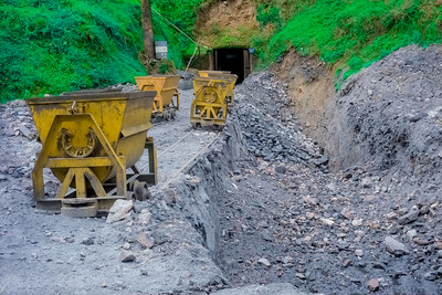
Joseph Mugabo from the Rwanda Mines, Petroleum and Gas Board (RMB) explains that the Geopark concept extends beyond mere rock preservation or mining; it is about the sustainable utilization of geological heritage:
“The Geopark model aligns perfectly with Rwanda’s sustainable development goals. It promotes the responsible use of our geological resources, not only for extraction but also for education, tourism, and community welfare.”
In essence, Geoparks bridge people and the land they inhabit. When communities, youth, and institutions work together, they cultivate a shared culture of stewardship and sustainable resource management.
Rwanda has the potential to become a continental leader in geotourism and geoheritage conservation, through informed and engaged citizens who value and protect their natural assets.
Prof. Asfawossen Asrat Kassaye, Professor of Geology at the Botswana International University of Science and Technology and member of the UNESCO expert mission to Rwanda, underscores the country’s exceptional geological potential:
“Rwanda’s northwestern and western regions host globally significant geological features, notably the Virunga volcanic chain and the Kivu Rift, which form part of the Western Branch of the East African Rift System. These areas are natural laboratories for Earth sciences, offering immense educational, research, and geotourism value.”
He emphasizes that establishing Geoparks in these zones will not only preserve their unique geology but also foster community participation through education, research, and sustainable tourism.
The Governor of Northern Province, Maurice Mugabowagahunde, shares similar optimism, describing the Geopark initiative as a vital opportunity to complement Rwanda’s expanding tourism sector.
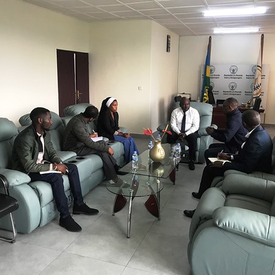
During the National Consultation Workshop on UNESCO Global Geoparks in Rwanda (September 29, 2025), he highlighted that the region’s natural assets,volcanic ranges, lakes, mineral deposits, eco-parks, and favorable climate,make it an ideal candidate for Rwanda’s first Geopark.
Rwanda’s geoheritage and potential Geopark sites
Rwanda’s natural beauty, geological history, and ecological diversity make it an outstanding candidate for UNESCO Global Geopark designation.
1. National Parks
Volcanoes National Park (160 km²): Hosts five major volcanoes originating from volcanic activity,an authentic showcase of Rwanda’s geological heritage.
Nyungwe National Park (1,019 km²): Characterized by ancient tectonic and erosional features, connected to the Gishwati–Mukura forest system.
Akagera National Park (1,122 km²): Features over ten lakes and extensive sedimentary formations, combining savannah and gentle hill landscapes.
2. Lakes and Rivers
Rwanda contains 24 lakes, including Lake Kivu (2,700 km²), and over 860 rivers, all formed through complex geomorphological and hydrological processes,providing valuable insights into the country’s tectonic and climatic history.
3. Mountains and Volcanoes
With more than 1,000 hills exceeding 2,000 meters, including Mount Karisimbi (4,507 m),Rwanda’s highest peak,the country holds prominent volcanic and tectonic landforms ideal for Geopark development.
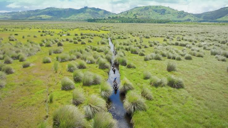
4. Wetlands and Forests
Wetlands cover approximately 10% of Rwanda’s surface area, playing key roles in soil conservation, water regulation, and hydrogeological research.
5. Geological Formations
Distinctive volcanic and granitic rocks, such as those in Gisenyi, represent rich geological archives of ancient magma activity and are prime candidates for geosite mapping and protection.
Rwanda’s integration of geological heritage with community-driven development embodies the spirit of UNESCO Global Geoparks,celebrating the interaction between people and the planet.
With its vibrant landscapes, active citizen participation, and growing policy support, Rwanda is well-positioned to become a model for community-based geotourism and sustainable Earth heritage conservation in Africa.