Flooding and environmental degradation in Mugogo valley
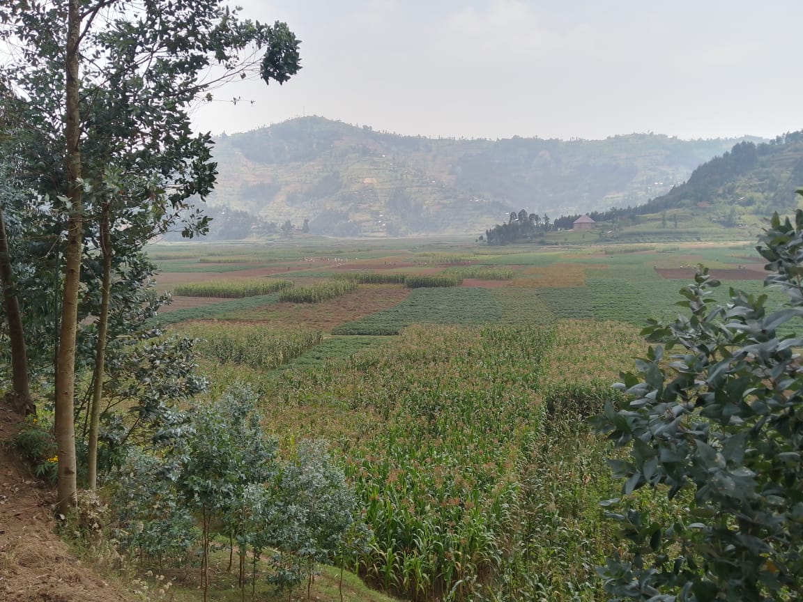
The Mugogo Valley, located in the Kabaya Village, Busogo Sector, Musanze District, frequently experiences recurrent floods primarily caused by rainwater flowing down from the surrounding hills in Musanze and Nyabihu.
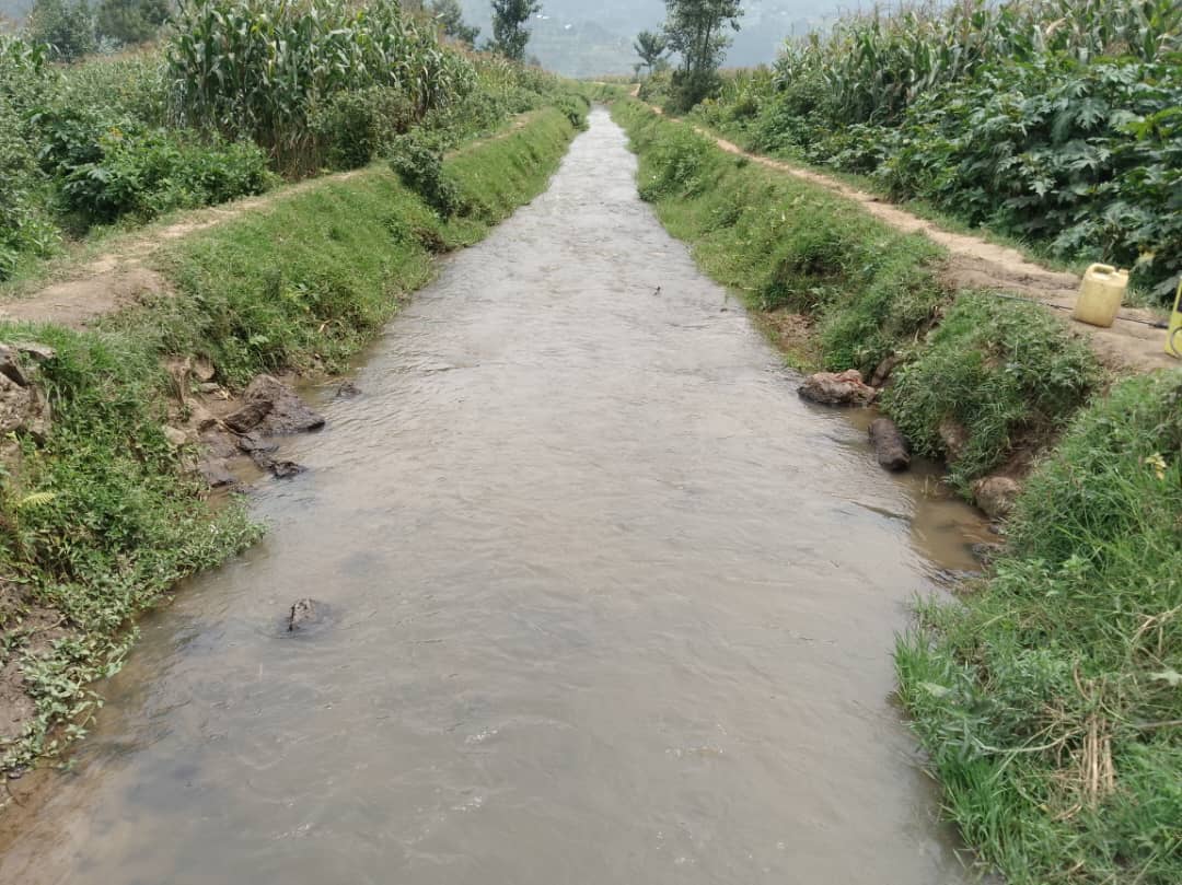
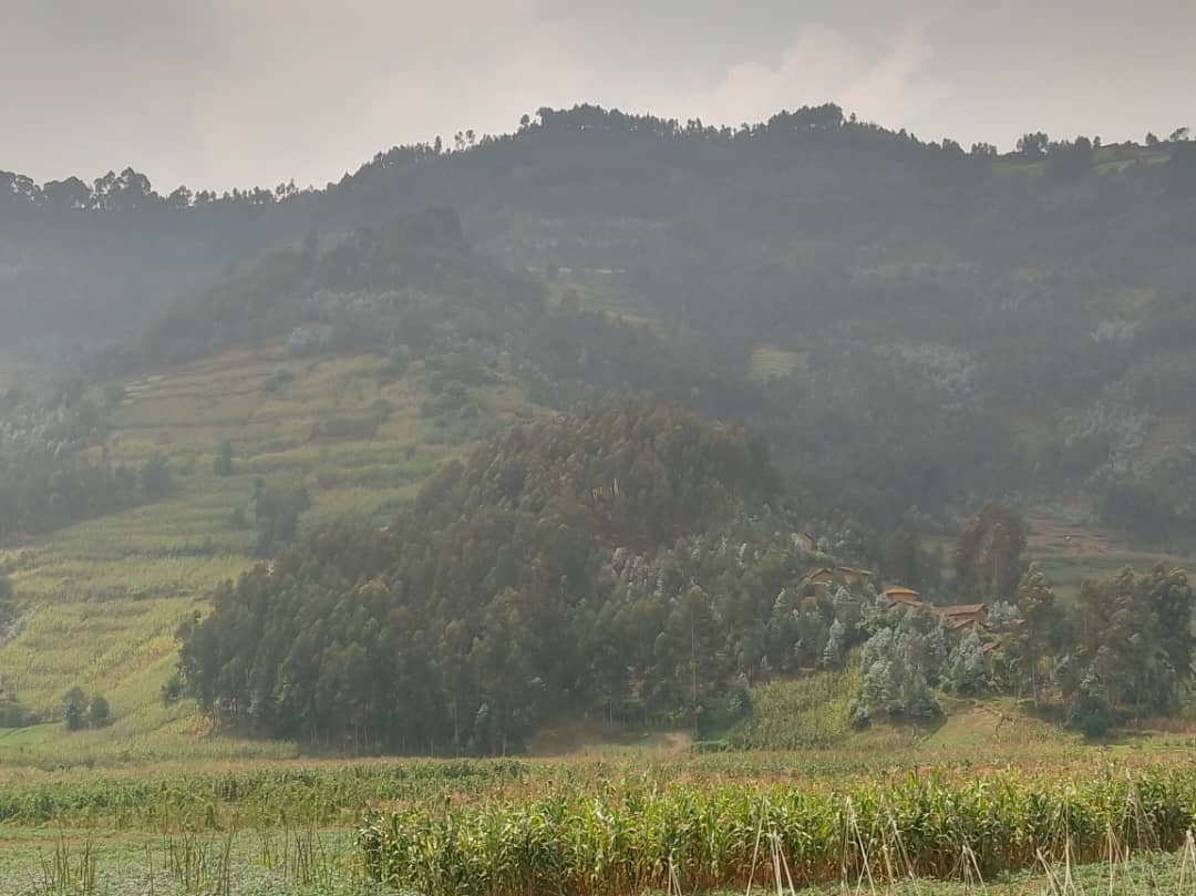
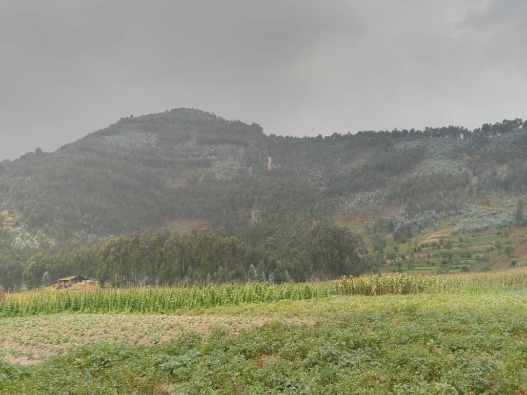
This valley, situated near the Byangabo area, is a major agricultural zone and is traversed by several streams, including Kinoni and Mugogo, which receive rainwater from high-altitude hills in Nyabihu such as Runigi, Buheno, Mugogo, and Karuriza.
Former residents and farmers in the area shared insights on the origins of the water that flows from these hills and its impact on the environment and agriculture.
Many believe the problem is driven by climate change, exacerbated by deforestation, poorly planned farming, and population displacement into unsuitable areas.
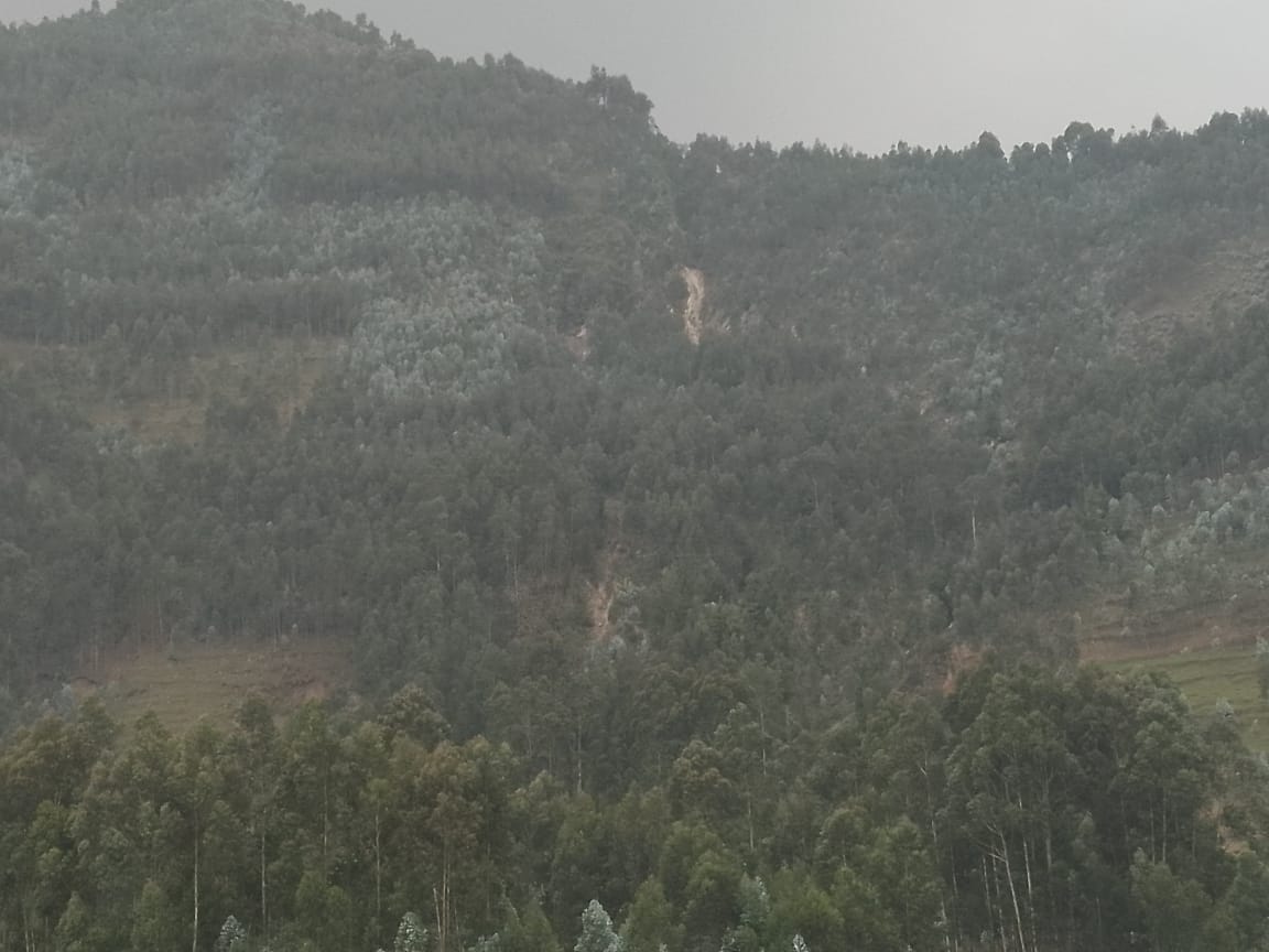
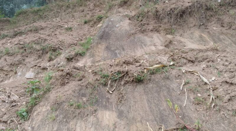
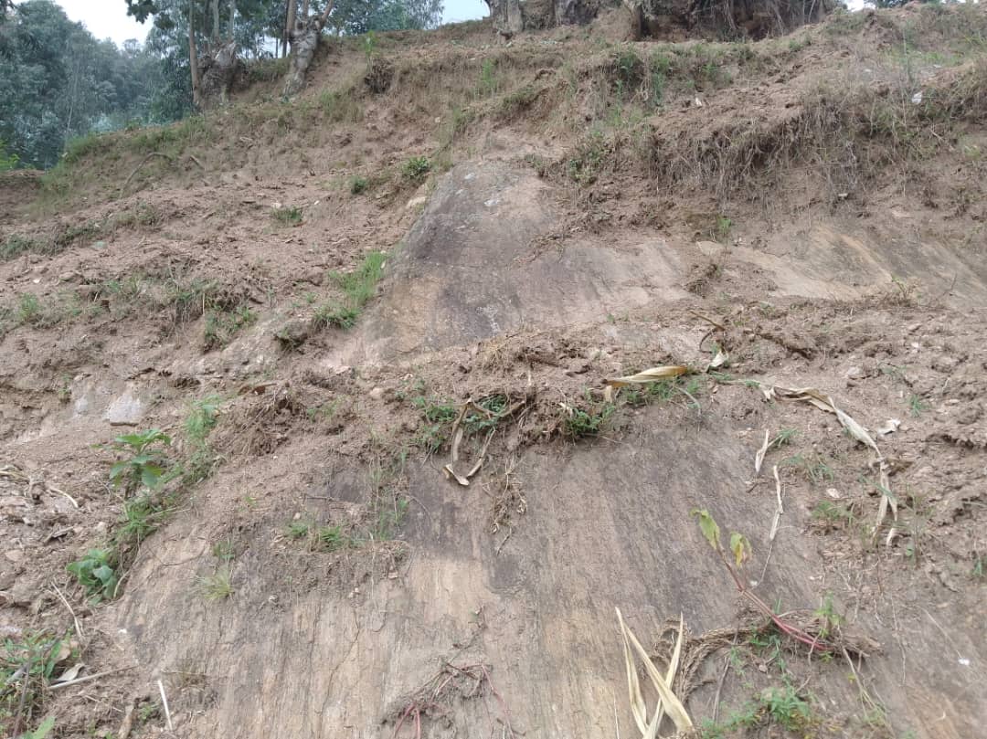
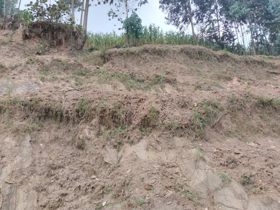
Large portions of forest that once covered these hills, particularly in Runigi and Mugogo, were cut down. Although some trees were replanted, they have not grown enough to stabilize the soil effectively.
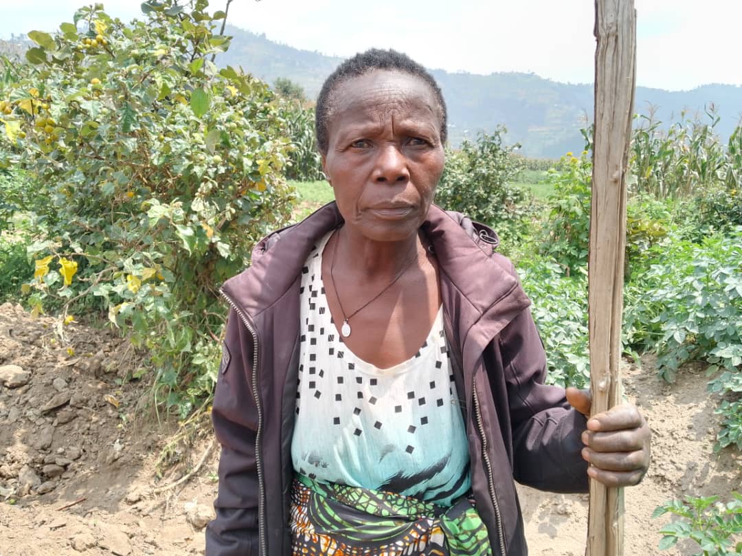
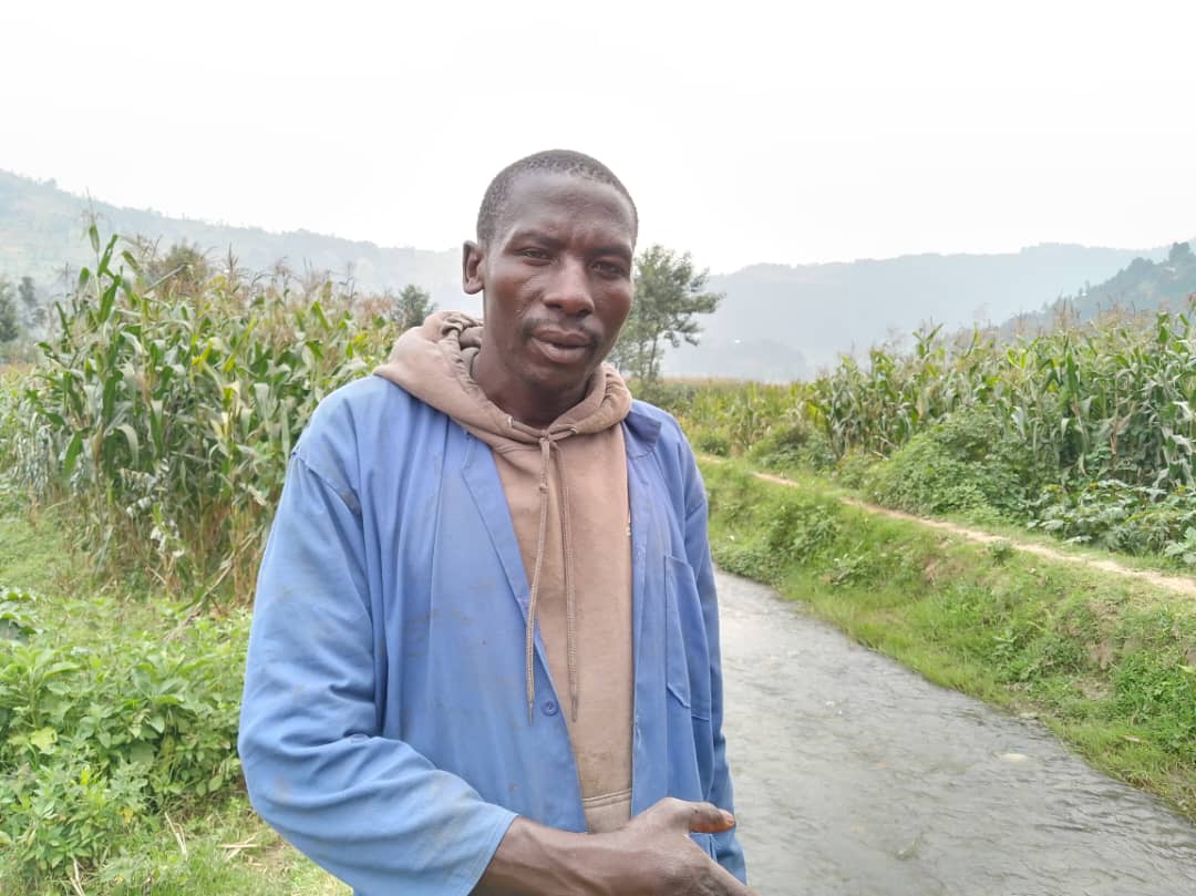
Among those we interviewed were Nizeyimana Emanuel, Nyirabazungu Specioze, and Mugabo Samuel, who provided valuable information about the valley, its waterways, and the surrounding hills.
Before 2000, the valley had a dense population, with most residents living in traditional huts made of papyrus, commonly known as “Nyakatsi.” These huts played a role in absorbing rainwater, preventing excessive runoff into the lowlands.
Following the government’s initiative to eliminate Nyakatsi houses between 2009 and 2010, residents started constructing sheet-metal-roofed houses.
Nizeyimana stated, “Nyabihu District receives heavy rainfall, especially in areas like Gitwa and Ruperera. As rainwater accumulated on metal roofs, it flowed rapidly downhill toward Kabaya, triggering severe floods that forced many residents to relocate.”
Specioze added, “Another major issue is deforestation. The forests that once regulated water flow were destroyed, removing the natural barrier that slowed down runoff. This caused water to rush down at high speed, overflowing the Kinoni stream and transforming wetlands into temporary lakes. When the water recedes, the soil is left dry and unproductive for farming.”
As flooding intensified, farmers began relocating to the hillsides, making the soil more fragile and increasing erosion. This led to significant sediment deposits in the Kinoni stream, further raising water levels and worsening the floods.
Residents have called for urgent interventions, including the construction of proper drainage systems using retention basins, terracing the hillsides to reduce erosion, and redirecting excess water into major rivers such as Mukungwa and Nyabarongo to protect agricultural land.
Musanze District’s Vice Mayor for Economic Development, Uwanyirigira Clarisse, stated that measures are being planned to protect both agriculture and the environment in Mugogo.
“In collaboration with the Rwanda Water Resources Board, we are conducting a study to find sustainable solutions. While we await its completion, we have mobilized a local farming cooperative to regularly clear drainage channels to prevent further flooding,” she said.
Musanze District’s Environment Officer, Wishavura Marie Grace, explained that former settlements turning into wetlands result from various factors, including climate change and human activities.
She stated, “Climate change, poor agricultural practices, and other developments on the surrounding hills all contribute to these floods. If these activities are not well managed, they can cause entire areas to be submerged. Additionally, unpredictable rainfall patterns can disrupt traditional water management strategies, as seen in Mugogo.”
She further emphasized that Musanze’s growing population has led to increased human activities, requiring authorities to implement measures to protect both residents and the environment. These include relocating former inhabitants, designating the area for farming, and reinforcing the surrounding hills with anti-erosion measures.
A new project, the Volcano Community Resilience Project (VCRP), aims to study water flow from the volcanoes and high-altitude hills affecting Musanze, Nyabihu, and neighboring districts. The study will examine whether the floods originate from human settlement, agriculture, or deforestation to develop a long-term solution.
The project, spearheaded by the Ministry of Environment alongside agencies such as REMA, Rwanda Water Resources Board, and Meteo Rwanda, seeks to mitigate water-related environmental and agricultural damage.
Marie Grace acknowledged that while roofing materials may have contributed to the problem, it is not the primary cause.
She said, “It is possible, but it’s not the main factor. That’s why we educate people on sustainable farming techniques, preventing soil degradation, and avoiding farming too close to steep slopes. The soil here is fragile, and when disturbed, it washes down, blocking waterways and increasing flood risks.
However, factors such as poor water retention systems, unplanned agriculture, unregulated settlement, and lack of erosion control measures all play a role. The issue is multifaceted, involving both climate change and human activities.”
Regarding the Kinoni stream, which frequently overflows and exacerbates the flooding, Marie Grace noted that the ongoing study would determine whether to divert its flow or implement alternative measures, as improper intervention could lead to further complications.
As part of Rwanda’s 2050 climate resilience strategy, Musanze District has already implemented various conservation efforts, including constructing both radical and progressive terraces, integrating trees into farming systems, and protecting local water bodies.
This year, the district plans to restore 19 kilometers of riverbanks and wetlands in VUP-targeted areas and construct soil conservation terraces on over 200 hectares of land.
In 2024 alone, 20 hectares of forest were rehabilitated, 380 hectares of radical terraces were constructed, and 675,772 non-fruit and 14,566 fruit trees were planted.
Juliet Kabera, an environmental expert and a leader in government institutions, currently serving as the Director General of the Rwanda Environment Management Authority (REMA), spoke with Greenafrica.rw and highlighted climate change as a key driver of the transformation of settled areas and agricultural land into wetlands.
She said: “Given the topography of our country, which consists of many hills, valleys, and wetlands, we have traditionally used these areas to absorb rainwater, build water channels, and create pathways for movement. We have also used them for farming. However, due to changing weather patterns, rainfall has become more intense, with rainfall volumes now reaching nearly double the usual amount within a short period.”
“Additionally, with increasing human settlements, as the population grows, we are building more houses everywhere. Areas that used to allow water to seep into the soil are now being built on, and thus, when the rain falls, the water has nowhere to go.”
She continued, “The water now rushes down into the wetlands and valleys, where people have settled, instead of soaking into the ground. What used to be farmland or other types of land is now urbanized, causing flooding in places that shouldn’t have been built upon.”
The director also discussed a solution where people could be encouraged to build houses with water catchment systems and rainwater storage tanks, alongside digging trenches to reduce surface runoff.
Although this is a helpful step, she emphasized that it cannot provide a permanent solution.
She said, “These methods are useful, but even if you have two water storage tanks at your home, they will fill up quickly during heavy rainfall, and when the water exceeds the tank capacity, it will flow to areas where it could cause damage. That’s why the water management agency is preparing various locations to build large dams that can store huge volumes of water, which could be used for irrigation and fish farming during the dry seasons.”
“On both sides, we need to prevent floods. Where construction is necessary, it should be well-planned, and trees should be planted to absorb water. Wetlands should be protected, while the water that previously flowed into roads and fields will now be reduced,” she added.
As part of sustainable development efforts, Rwanda has implemented several strategies to protect the environment and prevent natural disasters. Through policies and laws regulating environmental protection, initiatives like afforestation, resettlement of people in disaster-prone areas, and the use of renewable energy, the country is addressing the impacts of climate change.
Institutions such as REMA and the Ministry of Emergency Management (MINEMA) collaborate in disaster prevention and response efforts, with a strong focus on public awareness campaigns.
Programs like the “Green Growth and Climate Resilience Strategy” aim to promote environmentally sustainable economic development, while the push for electric vehicles seeks to reduce greenhouse gas emissions.